Willamette Wildlands Initiative
Acquiring, Protecting and stewarding Natural lands along the Willamette River

A sweet backwater area surrounded by floodplain forest.
Over the past few years, Willamette Riverkeeper has sought to acquire land along the river and in the wider watershed in order to protect them for the long term. Our goal is to protect what is in good shape, and also with lands in marginal condition, to restore them. At times such land can also provide opportunities for low impact recreation, providing access and/or camping along the Willamette Water Trail. We believe that the Willamette’s “Wildlands” are essential to the river’s health, and human health as well.
While WR is not a land trust, we have strong conservation values, and believe we are a value-added partner in conserving land for the long term. In the face of climate change, such riverside wildlands can provide essential habitat for a range of species. With hotter summers, leading to warmer water - every acre of land we preserve along the river now can help species survive during challenging times.
As the human population of the Willamette Basin grows, it is also essential to protect these places now, and to provide opportunities for low-impact outdoor recreation for all!
As part of this effort, WR has established an Endowed Fund at the Oregon Community Foundation. A significant portion of this fund is for the long-term protection of WR’s properties. If you would like information about how to contribute to this fund, contact Michelle Emmons.
See below for information about our properties.
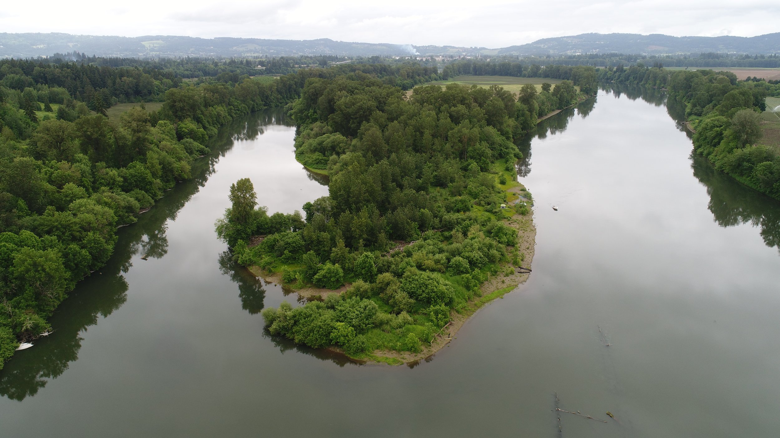
Norwood Island

Norwood looking downstream.
At approximately 85 acres, Norwood Island is Willamette Riverkeeper’s first conservation property. WR acquired it with funds from a wide range of our members in 2017. WR had known the landowners for several years, and they called us one day offering the island. We agreed on a price, and let our members know about it. The island, once farmed, had a significant restoration planting conducted in 2003/04. A mix of Pacific Willow, Oregon Ash, Douglas Spirea, Willamette Valley variant of the Ponderosa Pine, Nine bark and other native species were planted.
Today many of those plantings are mature, with some of the pines topping 25 feet in height. WR maintains a public Water Trail campsite on the lower end of the island. WR’s work on the island focuses on the removal of invasive species, such as Teasel, Himalayan Blackberry, and Reed Canary grass. Like other floodplain properties, these species can diminish the available habitat for native species to flourish. If you are interested in one of our work parties on the island, get in touch with us.
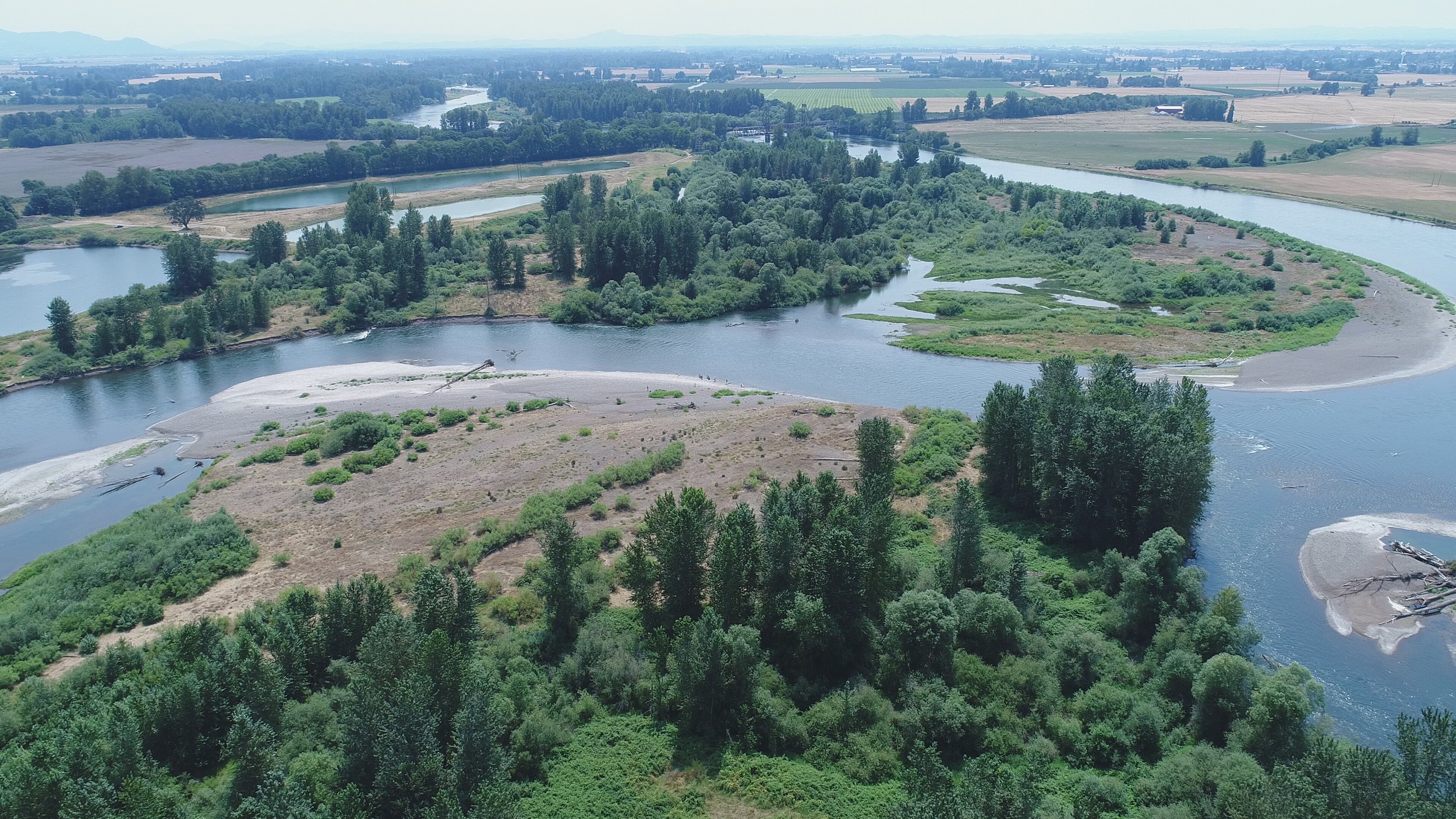
Along the side channel at Norwood Island, the Long Tom River confluence can be found. With that, the side channel is also home to over 40,000 freshwater mussels. These mussels can live to be over 100 years old in the right conditions. A study conducted by WR in 2017 determined that the mussels at Norwood are very old, and the population is not reproducing. To learn more, see our species page with links to the studies.

Norwood looking upstream, Southwest. The Long Tom flows in from the West.
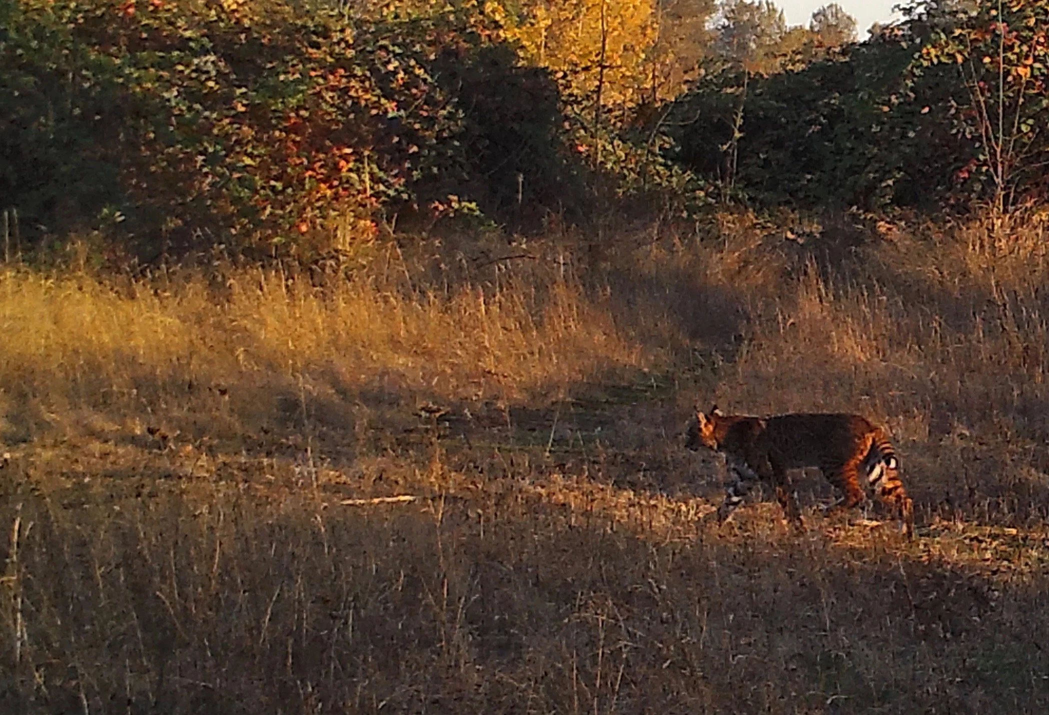
Bobcat at Norwood Island
Ash Island

Ash Island
WR purchased 10 acres on the upstream end of Ash Island (total of 147), in 2020. The parcel owned by WR is in Yamhill County, just on the edge of Newberg, OR at River Mile 52. The parcel is a node of green in a part of the river that has few public properties.
Ash Island - looking North.
The property has a nice combination of native plant species, from Nootka Rose to Black Cottonwood and Oregon Ash. Due to its low floodplain habitat, it was never farmed. A large portion of the rest of the island has been farmed over the years.
During the summer one can camp along the beach, and take a walk inland to witness a range of migratory birds. In time WR may work to obtain more of the island, but that is a work in progress.
To paddle to our property at Ash Island, one can travel upstream from Roger’s Landing and get there in about 25 minutes. The side channel on the West side is typically calm and quiet in comparison to the mainstem side of the river. During about 8 months of the year, this portion of the river can be pretty quiet and peaceful, making it a nice Spring or Fall site to visit.
The Sanctuary

Canoes on the beach at the Sanctuary
WR’s 100 acre Sanctuary property was donated by WR members Gorham and Robin Nicol in 2017. It is a large inside bend of the river at river miles 63-65. Once a property that was farmed, agriculture was ceased at the site in the late 1990s. Since that time several native plantings were conducted, and afterward the site was left largely unmanaged.

Sanctuary Property - looking North.
After discussing the property’s future with the Nicol family they decided our conservation vision fit well with their vision and soon after they donated it to WR.
While there are some nice plantings on-site, more needs to be done. Significant work on invasive plants needs to be conducted, and additional plantings should occur as well. Stay tuned for dates in 2023 to join volunteer work parties at the site.
About 25 acres of nice floodplain forest exists on the site, which is in good condition overall. In addition, there is a Water Trail campsite available for public use (for paddlers), that is on the large gravel beach along the property. There is a loop trail on the property that offers an excellent opportunity to hike, bird watch and more. It takes about 45 minutes to walk the full trail. This is a fantastic property that has access only from the river.
OSPREY Landing
This 52 acre island property sits just above Harrisburg in Lane County. It is technically two islands, with the dividing line between the two being a long channel that dead ends on the upstream end. The property has some very nice backwater habitat.

Osprey Landing Looking West, main channel in foreground.
Osprey Landing looking upstream (south), with the main channel on the left, and side channel on the right.
In 2022 Willamette Riverkeeper was contacted by Lane County, inquiring if WR would be interested in owning the property, and of course we said yes! Given WR’s experience and expertise in traveling the Willamette River by paddle craft, Lane County thought that WR may be a better steward for the property, given their constraints in terms of river travel.
WR took possession of the property in November of 2022. Over time we will develop a simple loop trail of much of the property, and will conduct work to remove invasive species. A ten acre portion of the island’s west side along the side channel is privately owned.
The large gravel bar makes a good campsite for those traveling by canoe, kayak, or drift boat. As always on these properties, people must utilize the Leave No Trace ethic!
Stay tuned for more about Osprey Landing soon!
The PEARLSHELL RESERVE
At the confluence of Crabtree Creek and the S. Santiam River, WR purchased a 25 acre property we call the Pearlshell Reserve. This glorious property has some very nice habitat, and notably, it has a sweet population of Western Pearlshell Mussels along the lower mile of Crabtree Creek.

The Reserve, with Crabtree on the right, and the S. Santiam on the Left, looking north, or downstream.
The Reserve’s lower gravel bar also makes a nice campsite for low impact camping along the S. Santiam.
While the property is the end of a peninsula, it is accessed only from the river. Over time WR will conduct some invasive species removal, yet overall the Reserve’s ecological condition is robust.

Lower Portion of the Pearlshell Reserve.

Western Pearlshell Mussels in lower mile of Crabtree Creek.